

“Study of the sinking of the Atacama Salt Flat using synthetic aperture radar images” is the title of the study conducted by Roberto Montoya Araya and Marisol Alegría González, both students of Land/Geomatics Engineering, whose lead professor is Dr. Marcelo Caverlotti.
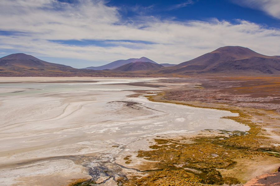
The record will measure the terrain of the largest salt deposit in Chile, which according to a recent study led by the University of Chile, is sinking at a rate of between 1 and 2 centimeters per year.
This phenomenon would occur due to the loss of groundwater, which the aquifers to compact and lose permeability.
“Subsidence not only affects the surface of the salt flat but also has long-term consequences for the infrastructure and sustainability of the aquifers in the region. In addition, local indigenous communities have filed complaints for environmental damage, as the subsidence affects their ancestral territories and their way of life,” said the academic from the Department of Geospatial and Environmental Engineering (Digea). Dr. Marcelo Caverlotti Silva.
It is crucial to address this problem by implementing sustainable management measures and reviewing environmental permits to mitigate negative impacts on the Salar de Atacama and its communities.
“The use of synthetic aperture radar (SAR) imagery has proven to be an effective tool for measuring subsidence. Through the SAR interferometry technique (InSAR), deformations in the earth’s surface can be detected with high precision. This methodology makes it possible to observe vertical changes in the terrain, which are indicative of subsidence, mainly caused by the overexploitation of underground aquifers,” said the expert.
The project stemmed from a meeting between the students and the academic, who told them about the phenomenon occurring in the Salar de Atacama and that it could be measured by radar images.
“The study will also have the support of Professor Jaime Backit, who has vast experience in mining prospecting using satellite images. In the end, the idea became concrete for our degree project in which we hope to identify and quantify the deformation patterns that are occurring in the Salar de Atacama with SAR images,” said thesis student Marisol Alegría González.
As for the objectives of this research, the aim is to project the subsidence of the Salar de Atacama, which will help to foresee its outcome and generate options to stop the collapse.
“The importance of this study is to make this phenomenon visible, even more so that other institutions join this research, increasing the options to prevent the salt flat from sinking. It also shows that SAR images are useful and accurate for monitoring deformations in terrain such as salt flats, to set precedents that can be used in future studies in other areas,” said thesis student Roberto Montoya Araya.
For the dissertation research team concerned with the sinking of the Salar de Atacama, this study is an opportunity for our University to consolidate its position as a reference in the application of advanced technologies, such as SAR images, in the analysis of complex environmental problems. The results will be of interest to the national mining industry, since it will be possible to establish sustainable practices that minimize impacts on the ecosystem, protect subway aquifers and reduce social conflicts related to lithium extraction.